Day 5: Alaska Basin lakes to Sunset Lake via Static Peak summit; 7.5 miles, 2100 ft gain
We did another side hike on day 5 before spending a second night in Alaska Basin at Sunset Lake. The side hike to summit Static Peak is an incredible one!
In the summer of 2021 I hiked the Teton Crest Trail with friends. Set in Grand Teton National Park, it is one of the most beautiful hikes in the country. It varies in length depending on the trailhead you use, but the basic TCT is about 40 miles with ~9000 ft of elevation gain. You can easily customize the hike length by adding side hikes; we ended up hiking 53 miles and ~11,000 ft.
It can be hard to get permits online when they become available. Luckily I just showed up the day before I wanted to start hiking and got walk up permits. There are walk up permits available everyday. Just go in with several itineraries and the rangers are happy to work with you. Also, the Teton Crest Trail goes in and out of National Forest where you don’t need permits to camp making it relatively easy to put a route together. I had booked a campsite at Colter Bay in the National Park for the first two nights so we had a place to stay while we prepared for an early morning queue at the ranger station to snag permits. However, we got permits the first afternoon we arrived and were able to start hiking the next day.
Day 19: 11.2 miles, 207.4 cumulative, Guitar Lake to Outpost Camp (10,370′)
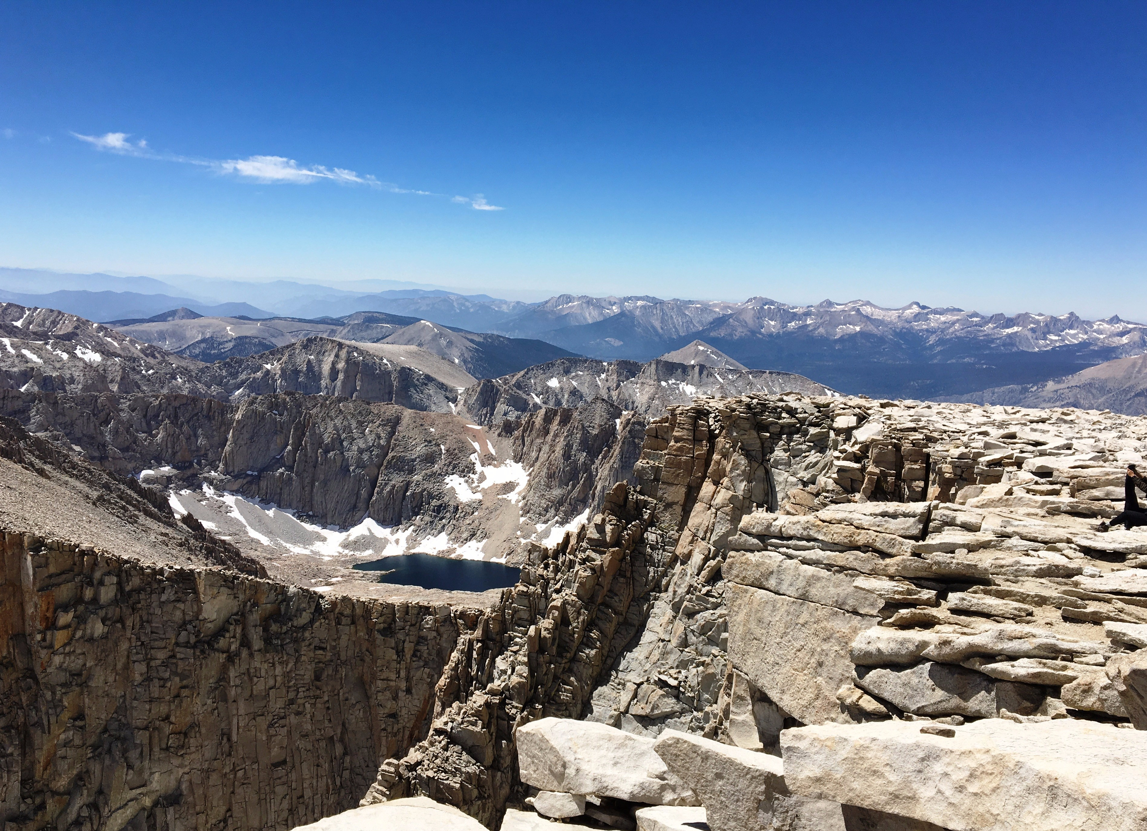
This was the day. We would summit Mt. Whitney and complete the John Muir Trail. The culmination of months of planning and weeks of hiking. In the end we would climb 3000′ and descend 4000′ in one long and glorious day. I was elated to have made it this far, nervous about the climb to come, ready to have real food and a shower, and sad to be at the end of an incredible journey. Lots of emotions there…
Day 17: 10.5 miles, 184.5 cumulative, Center Basin to Tyndall Frog Ponds (11,030′)
I woke early and crawled out of my tent. I was surprised to see many of the backpackers already moving around – everyone was so quiet. We all knew what was ahead I guess. And that would be Forester Pass. At 13,110′ Forester was our highest pass, and 1000′ feet higher than we had even been so far. I knew the climb would be super hard…2700′ feet up with less than optimal oxygen. But out there on the trail, no matter how hard the climb or how much I wanted to quit in the moment (and there were plenty of those moments), quitting literally wasn’t an option. My only choice was to keep hiking. And so…
Day 15: 13.7 miles, 162.1 cumulative, Lake Marjorie to Dollar Lake (10,220′)
Today’s pass – Pinchot Pass (12,050′). It wasn’t a terribly hard pass (although all climbs over 11,000′ still made me miss oxygen greatly). Nathan and I had camped at 11,000 feet so we had just 1000′ to climb in 2 miles. The snow wasn’t tricky or scary this time. 🙂 After our usual break on top of the world, we began our 3500′ descent to Woods Creek.